The Best Kazakhstan Map
Google's Interactive Kazakhstan Map
This Google map of Kazakhstan can turn into a satellite map or a terrain map, by simply selecting the mode you prefer most from the top left of the map.
Political Map of Kazakhstan | Physical Map of Kazakhstan | Kazakhstan Provinces | Almaty MapView Kazakhstan interactive map in a larger map
use up and down arrows, as well as right and left arrows to go up north, down south, east and west;
alternatively, use the hand cursor to drag and move the map where you want to;
moreover zoom into the street and even the buildings, as well as zoom out to see the neighbourhood: China, Kyrgyzstan, Russia, Turkmenistan and Uzbekistan.
Google Map of Kazakhstan
With the Google map above you can actually have a trip to Kazakhstan, virtual, but still a trip. No need worrying about the weather, dirtying your shoes, going through all the bother of getting a visa, taking a flight, renting a car. Phew. Just sit and click. You can also nip out to the neighbouring countries, no extra charges, no visas, no borders.
But still not the same as the physical trip, ain't it? Ha?
Now tell me that this was the type of map you were looking for? Right? Right?
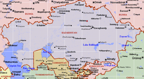
Political Map of Kazakhstan
Please click on the map to get a larger Kazakhstan map in a better quality.
Courtesy of SiteAtlas
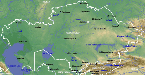
Physical Map of Kazakhstan
Courtesy of SiteAtlas
Political Map of Kazakhstan and its Provinces
This Political Map of Kazakhstan shows the Provinces of Kazakhstan called the "Oblasts". There are 14 Oblasts and 2 cities with status of State importance. They are Astana and Almaty.
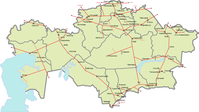
Map of Kazakhsta Railways
Image credit to Wassilly on Wikipedia
You know what? There is another place you could look at if you wish and it is not too far. It is just here. Just follow this link for more Maps of Kazakhstan.
By the way, before you go, if you need more maps come and check this page now and again.
Follow this link to the Almaty map
Return from the Best Kazakhstan Map to Ultimate Guide to Kazakhstan Home Page


